


Border Route Trail Offline Map app
free Border Route Trail Offline Map app
download Border Route Trail Offline Map app
Border Route Trail Offline Map apk
free Border Route Trail Offline Map apk
download Border Route Trail Offline Map apk

Border Route Trail Offline Map
0.0


10++


Name
Border Route Trail Offline Map

Developer
GeoPOI LLC

Price
$0.99

Updated on
2020-03-25

Category
Maps & Navigation

Version
1.0.1


About This app
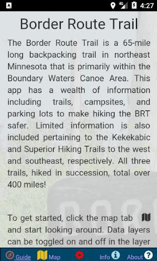
The Border Route Trail in the Boundary Waters Canoe Area is one of the most remote and rugged backpacking trails that Minnesota has to offer! Straddling the Canadian Border, this 65-mile trail offers spectacular views and pristine wilderness for those tough enough to handle it!
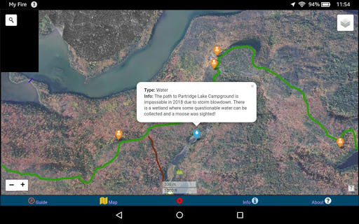
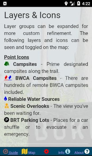
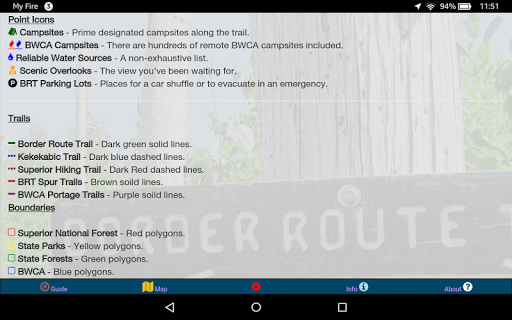
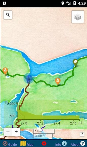
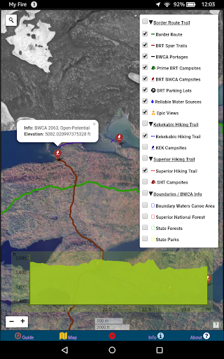
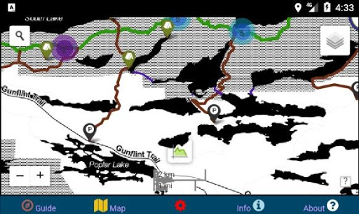
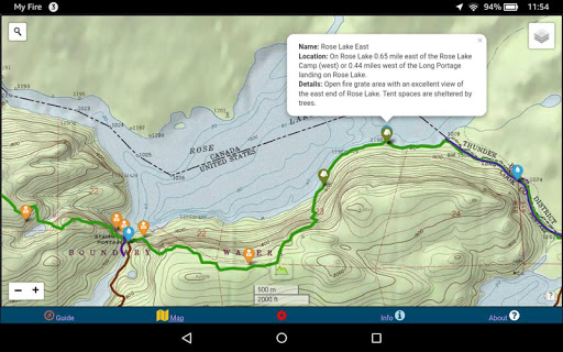
This app was created to assist wanderers in their journey along the BRT. It is loaded with useful trail information including the route of the BRT, portages, spur trails, campsites, vistas, water sources, parking areas, boundaries, evacuation points, and much more! Each data point and trail line is interactive, providing more information when upon tapping. The icons are informative and color-coded for immediate recognition, and layers that are not being used can be turned off to simplify the map presentation.
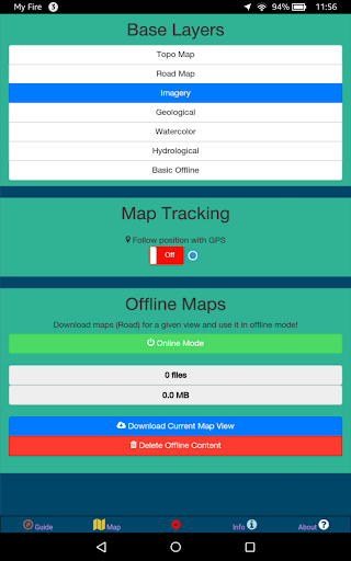
Offline imagery and topographic maps are bundled along with this app so that there is no need for an internet connection after installation. This is important, as the BRT is so remote that any kind of cell phone reception is highly unlikely. The app has the option to utilize GPS to follow your position on the map. This too is very essential, as many parts of the BRT are overgrown, crossed by other trails, and poorly marked. Having the confidence that you are staying on the trail is a blessing when you wish to avoid needing to backtrack.
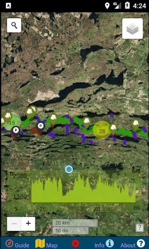
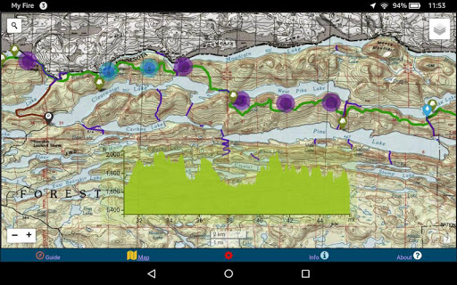
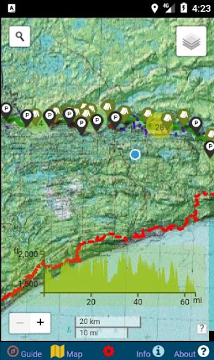
In addition to a map view presentation, there is also a cross-sectional view of the BRT that can be expanded so that you can easily see where the ridges and valleys are. Highlight a portion of the cross-section and you can zoom in to that specific part of the trail. Much quicker and easier than trying to read topography from a map!
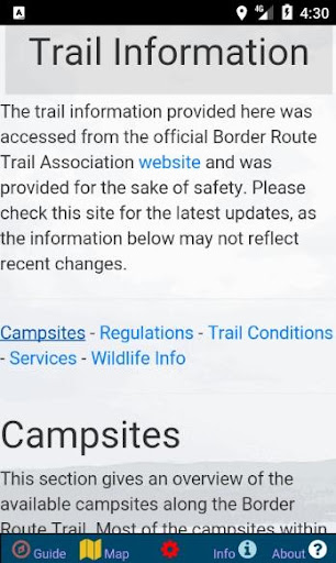
For those who prefer a more traditional information delivery style, there are a series of sections dedicated to describing the trail conditions, campsites, and other info through writing. This information is always changing, so be sure to check for the most recent updates at the official Border Route Trail Association website!
This app was designed for the BRT and tested on the trail. It has already proven to be invaluable for anyone considering hiking sections or the entirety of the trial. Although the Border Route Trail may be shorter and lesser-known than some other trails, it has a purity and ruggedness that set it apart from the rest. There is truly no better way to experience the Boundary Waters Canoe Area than on foot!
Show More
Screenshots

Comment


Similar Apps


Top Downloads


Copy [email protected]. All Rights Reserved
Google Play™ is a Trademark of Google Inc.
ApkYes is not affiliated with Google, Android OEMs or Android application developers in any way.

