


Avia Maps Aeronautical Charts app
free Avia Maps Aeronautical Charts app
download Avia Maps Aeronautical Charts app
Avia Maps Aeronautical Charts apk
free Avia Maps Aeronautical Charts apk
download Avia Maps Aeronautical Charts apk

Avia Maps Aeronautical Charts
4.3


100K+


Name
Avia Maps Aeronautical Charts

Developer
Remy Webservices UG

Price
Free

Updated on
2023-10-23

Category
Maps & Navigation

Version
3.11.6


About This app
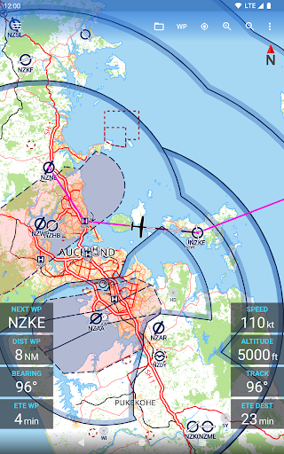
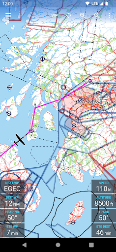
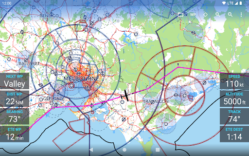
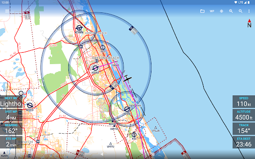
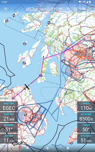
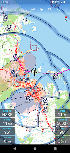
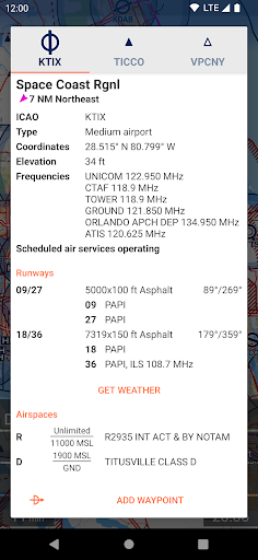
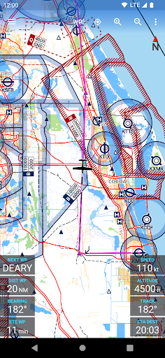
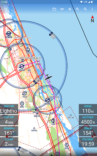
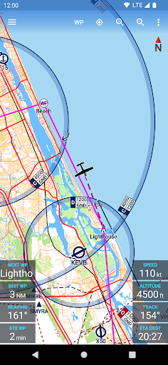
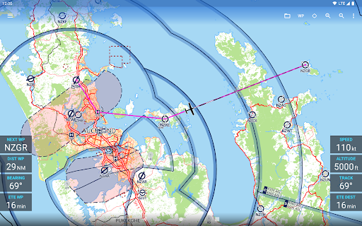
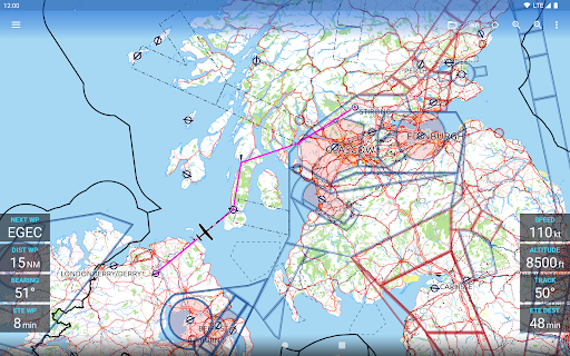
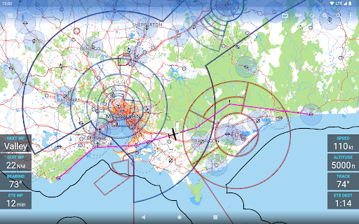
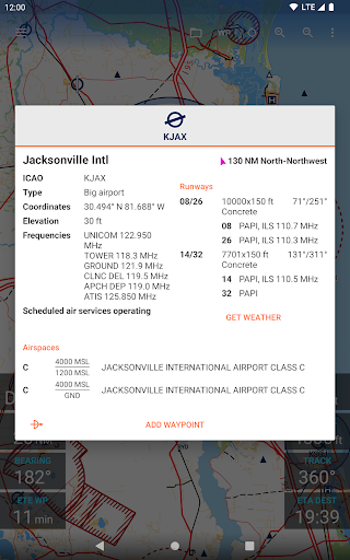
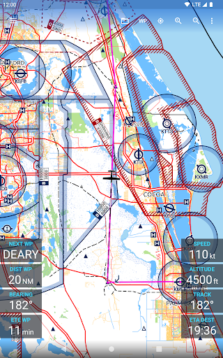
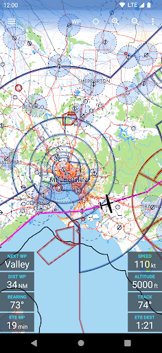
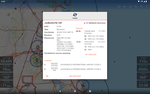
The reliable and straightforward aviation maps for pilots and aerospace enthusiasts around the world. The app is suited for pre-flight planning as well as in-flight navigation. Simply choose any 5 by 5 degree area on earth and download relevant data for offline use. The map features over 65000 airports, 9000 navaids and 15000 waypoints around the globe, just as airspaces for currently 62 countries on all continents (except Antarctica). Countries with airspace data include the United States and Canada, Europe, Australia and New Zealand.
Global, high resolution weather forecasts from the German DWD and US American NOAA provide accurate map layers for cloud cover, ceiling, precipitation, wind on the ground as well as aloft. The data is downloaded onto the device, so you can check the forecast even during flight without cell reception. To retrieve the latest METAR and TAF at your destination airport it is integrated with Avia Weather.
A digital elevation model supports you with planning your route in the mountains. During flight the terrain overlay will dynamically color hills and mountains on the map depending on your current altitude to increase your situational awareness.
To enhance safety, Avia Maps can display traffic information from your favorite ADS-B receiver or from the SafeSky app directly on the map. It supports receiving traffic data using the GDL90 format, which is supported by most portable ADS-B receivers like SkyEcho or Stratux. If you do not have a receiver, SafeSky can provide traffic data using an internet connection only.
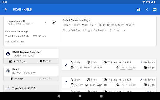
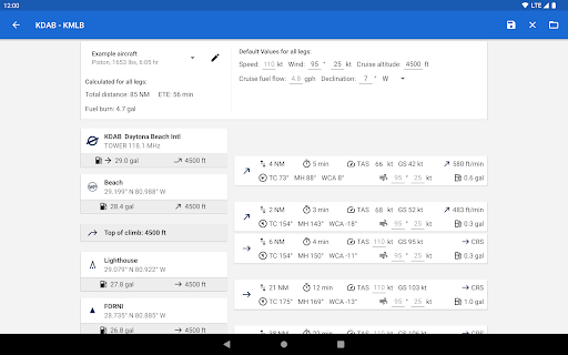
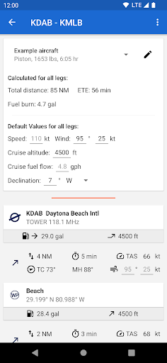
For the most accurate performance calculations you can create multiple aircraft profiles from handbook values for climb performance, fuel consumption etc. Route calculations will use these profiles and even consider engine type and fuel burn for climb performance, employing common formulae used in aerospace engineering. From as little as four carefully chosen data points the app can accurately recreate the climb performance diagram in your POH.
For clarity and commonality to paper charts the map is themed in the style of ICAO Annex 4 (Aeronautical Charts). If you use the app on multiple devices you can synchronize your routes, aircraft profiles and user waypoints between them.
This is a trial app with full features. After an evaluation period of 30 days you will have to buy a perpetual license from within the app or subscribe to the professional tier.
Show More
Screenshots

Comment
Similar Apps


Similar Apps


Top Downloads


Copy [email protected]. All Rights Reserved
Google Play™ is a Trademark of Google Inc.
ApkYes is not affiliated with Google, Android OEMs or Android application developers in any way.

